Feedback After Congnitive Walkthrough
Present
- Joshua Hooker
- David Morhardt
Slope field toe, lower, upper
assume upper and lower are equal
Instruction view/tooltip
Estimate cover -> anything not bare soil (i.e. rocks)
Also explanation of each input
Inputs
Latitude and Longitude
Soil texture, rock content, gradient
pulled from spatial WEPP database
Slope length, cover, climate, years to run, vegetation
Outputs
Only the first output table
mean annual averages for X years
Views
Homepage
Instruction
Inputs (two views)
Ask user for use of browser location data
Input address -> latitude, longitude
Results page
Feedback After Final Design Presentation
Present
- Joshua Hooker
Slope value from database is actually the slope gradient.
The rock content field has a range from 0% to 55%, not 0% to 100%.
Though, the model may clamp the value.
Confirmed that the the top and bottom gradient values are constant and the gradient input field is copied into the two middle gradient values
Mary will send the development team more information regarding the instructions for collecting and understanding the various input fields on the web app.
Add some more climate centers:
specifically the one in Ann Arbor and some near Houghton.
No strong preference for or against making the app a single page.
Mary gave the idea that we could put the latitude and longitude values on the homepage and keep separate from the inputs page.
Design Changes after meeting with Mary and Joseph and Ankitha
First Design Review with Mary
Climate model
state and year?
Nope
select location based on region
dropdown list or from GPS location?
review climate models
climate models are forestry stations
Gradient field
one or two?
Slope field
one or two?
Website validation with Javascript
Deploy early
HTTPBuilder packaged into the .war file
for the server
dependency in gradle build?
Another meeting with Mary soon
another paper draft
meeting 1
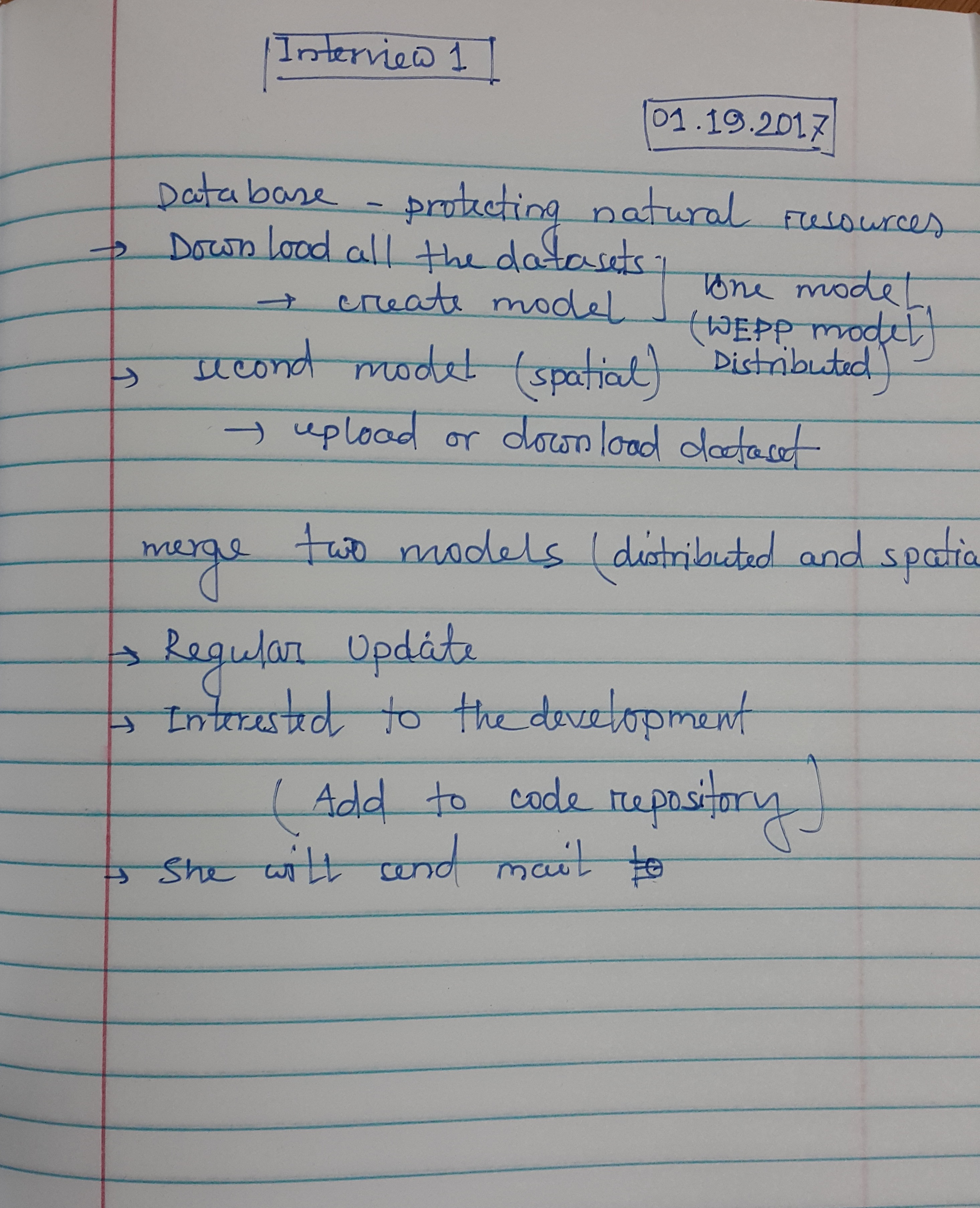
Meeting with Scientist (Recorded by Mohammad)
Meeting with Scientist (Recorded by Prakhar)
Present
- Prakhar Keshari
- Joshua Hooker
- David Morhardt
- Mohammad Sajib Al Seraj
- Joseph Rice
- Jialin Lei
- Ankitha Pille
Absent
- Ashley Huack
Notes
- What kind of users will we expect to use this application (possibly some examples)?
Citizen scientist, students, educators, may be by other people, forest services interested
-online database, soil texture, data not correct yet
Allow the user to modify data based on what they see in the field
-Some members need an explanation of the Disturbed WEPP Model 2.0
-app will have to query to two databases
-Are databases manipulatable?
Both are designed to be user-friendly, can be modified to our needs. We need a location, can be done using latitude and longitudes
-We will need to collect data from the user
-WEPP
It is a process based on hydrology model. 500 inputs go into running the model. Online interface to a WEPP model.
Built for BAER team, typically forest service personnel. 7 days to decide hydrological threat after fire. Uses remote sensing data.- What environment (at home, outside, etc... and what situations) would you expect the users to be in whilst using the app?
Students out on the field, or may be from home. Need internet or wifi on any mobile device
Can user collect data offline and then upload later on.?
Possibly offline mode.? Yes, if possible!
- Are there any requirements that you wish to outright specify?
Query the database
Be able to collect data from users(automated process to manipulate data?) feature to email scientist if there is something wrong in the database, scientist can review and make edits.
Login? Should be accessible to everyone, so probably not
Keep in mind, app could be
Allow user to gather information from phone, gps location and edit database from phone, would be beneficial for students for educational purposes
- Did you have a chance to look into licensing since the last meeting?
If not, do you want this application to be free/opensource or commercial?
Open-source?
yes preferably. Mary will check with her lead programmer
Can commercial entities use it to make money?
Don’t need to worry about at the moment
- Have you been added to the github page and do you want a short overview of how to use it?
She has been added, she hasn’t checked it out yet
Final Presentation Review
Present
- Joshua Hooker
- Jialin Lei
- Mohammad Sajib Al Seraj
During this meeting Joshua, Jialin, and Mohammad reviewed the final design presentation. We decided, who would speak on what part of the presentation:
- Mohammad is going to introduce the team and the project and later he will discuss usability concerns.
- Jialin will demo the application
- Joshua will review each view in the application and help out Mohammad and Jialin when necessary
Team Meeting with Usability Experts
Present
- Prakhar Keshari
- Joshua Hooker
- David Morhardt
- Ashley Huack
- Joseph Rice
- Jialin Lei
- Ankitha Pille
Absent
- Mohammad Sajib Al Seraj
During this meeting we discussed some changes that need to be made to the web application in order for usability testing to be useful. After demonstrating the use of the software to Joseph and Aniktha, they gave their recommendations for changes:
- Instructions for input fields
- An indication of either high or low risk based on some arbitrary threshold
- Fixing the map interaciton for latitude and longitude inputs
Final Meeting with Client
Present
- Prakhar Keshari
- Joshua Hooker
- Ashley Huack
- Mohammad Sajib Al Seraj
- Joseph Rice
- Jialin Lei
During this meeting we discussed the results of the usability test, some last minutes changes, as well as possibly features, which were not included in our porject. Mary was pleased with the results of the usability test: she was glad that students were able to use WEPA, despite having little to no experience with erosion modeling beforehand. Though, she was confused by the risk indicator that we included on the results page. So we explained why we added it and that there was a bug with the indicator text that has been fixed.
In addition, we discussed an issue with the climate input field that Mary had discovered recently, which Joshua was able to fix before the meeting. However, fixing the issue with the climate revealed that further development was necessary to allow climates, which are not part of the default list in the WEPP Model website, to be used in WEPA. Mary understands this and looks forward to seeing the final version of WEPA being deployed with a function climate field.
Finally, we brainstormed a list of possible features for WEPA, which were not included in this project:
- allow use of any climate used in the origin WEPP model website
- link climate list to the closest climate function on the WEPP website
- a greater list of vegetation options, with which citizens are more familiar
- after expansion of NASA BAER database, updating WEPP geared towards third world farmers
- offline usage of WEPA where the user can store input sets locally and run the model later. Also, storage for WEPP model results locally as well
- link WEPA with the BAER form project
- functionality for comparing the results of two WEPP model results
Overview of the system:
Stakeholders
- Users
- Secondary Stakeholders
- Tertiary Stakeholders
Forestry Managers (Expert)
Citizen Scientists (Novice)
Mary Miller (Scientist)
Professor Robert Pastel (Product Owner)
Developers
Joshua Hooker
Prakhar Keshari
David Mohrhardt
Ashley Hauck
Mohammad Seraj
Jialin Lei
Graduate Students
Joseph Rice
Ankitha Pille
Other Michigan Tech students and faculty
Personas
User Personas
- Name: Aaron Hale
- Age: 20
- Height: 5'6"
- Weight: 138
- Aaron is an undergraduate student studying the environmental engineering disciple. He is a prideful man, consequently, he has trouble asking people for help. In addition, he can be quite clumsy; for instance, he managed to set a large portion of his backyard on fire. Now he is concerned about soil erosion on the part of his yard, which was burned. Moreover, he is familiar with the factors, which influence soil erosion.
- Name: Lois Pearson
- Age: 54
- Height: 5'9"
- Weight: 154
- Professor Lois Pearson teaches bological science courses. He is quite soft-spoken and directionally challenged. Additionally, he is concerned with the impact of a recent fire, which plagued an entire hillside near his university's campus. Although, he is unfamiliar with the factors that are involved in soil erosion of exposed hillsides.
Environment
- Mobile friendly application
- Basically, web based application
- Need internet connection
- If it possible then add offline feature for data collection
Nominal Application Use
Scenario 1:
Aaron Hale is surveying the damage caused to his backyard from the fire he (accidently) started. From his studies as an environmental engineer, he is aware that part of the yard could be susceptible to soil erosion. To ensure that he can prepare for any further mishaps, Aaron decides to test the soil erosion and update the MTU BAER database with his findings. He navigates to the homepage of our application to request an update to the database with his new findings. The update is then reviewed by a scientist to ensure that it is indeed accurate and the database is updated.
Scenario 2:
Lois Pearson is out on stroll near the when he decides to take a look at the hillside near his campus. After noticing that the recent fire did quite a bit of damage, he decides to check the data of the soil around the area of the fire. He navigates to the apps main page where he then inputs his location to query the database for information of the surrounding area. Unfortunately he does not quite understand the information he is seeing so he takes the info to the local soil erosion team on campus. Making the team aware that there may be a problem, the scientists can then take care to ensure that soil erosion causes minimal damage to the buildings below the hill.
Hierarchical Task Analysis
Upper level views:
WEPP explanation view
WEPP instruction
Data collection view
Select database
Data submit
Database query view
Edit input parameters
Query data from database
Lower level views:
Edit input parameters view
Input latitude, longitude, hydrological parameters
Save
Cancel
Query data from database view
Upload user data to server
Query
Cancel
Audience and Task Analysis Memo
- TO: Joshua Hooker, Ashley Hauck, Prakhar Keshari, Mohammad Sajib Al Seraj, Jialin Lei
- FROM: David Mohrhardt
- DATE: January 27, 2015
The Soil Erosion Query application is to consist of forms that the user may use to query and input information from a set of soil erosion and BAER databases in a streamline manner. The application will be web based and the user will be capable of accessing this web application from many common desktop internet browsers (such as Google Chrome, Safari, Firefox, and Internet Explorer) as well as from their mobile devices. The queries and inputs will be made in a streamlined fashion allowing for more general users to make use of the application to detect the possibility of soil erosion. Once the user completes the forms (for a query or to input new data), the form will be sent off to a server and processed by our web application and the web application will then make the appropriate queries to the appropriate databases.
The application has three primary stakeholders: Mary Miller (Scientist), Forestry Managers (experts in the field of soil erosion and users of the databases), and citizen scientists (general users who may be novices when it comes to the field of soil erosion and utilizing the databases). Mary Miller needs this application to run in an efficient manner to help streamline many of the processes and procedures that users like the BAER teams and soil erosion experts currently need to perform under extremely tedious circumstances. It must be able to intelligently relay the information that the users need to see with minimal effort on the part of the user.
Sincerely,
David Mohrhardt
Database Schema
- The application won't require a database from development as the application is an interface with a database.
Members
| # | First Name | Last Name | |
|---|---|---|---|
| 1 | Joshua | Hooker | jbhooker@mtu.edu |
| 2 | David | Mohrhardt | dcmohrha@mtu.edu |
| 3 | Ashley | Hauck | echauck@mtu.edu |
| 4 | Prakhar | Keshari | pkeshari@mtu.edu |
| 5 | Mohammad | Sajib Al Seraj | malseraj@mtu.edu |
| 6 | Jialin | Lei | jialinl@mtu.edu |
| 7 | Joseph | Rice (grad) | jsrice@mtu.edu |
| 8 | Ankitha | Pille (grad) | apille@mtu.edu |
The application source: WEPA.zip
Team member contributions
Joshua Hooker- Helped Jialin with maintaining the website
- Helped put together and give the Cognitive Walkthrough and Design Review presentations
- Sent out announcements about the project to members
- Coordinated team and client meetings
- Communicate with our client, Mary Miller about progress on the project and feedback
- Worked with Jialin on designing the website prototype
- Developed the two main views of the web application
- Developed the logic for HTTPBuilder requests for both the NASA Bear query and the WEPP Model generation and parsing
Jialin Lei
- Worked on the Hierarchical Task Analysis
- Design a vast majority of the team website and uploaded most of the information for the website
- Designed the website prototype and implemented the initial input and results pages for the final product
- Helped put together the Cognitive Walkthrough and Design Review presentations also participated in the Design Review presentation
- Suffered with Joshua through the initial integration of the HTTPBuilder plugin
- Designed a erosion risk analysis indicator for the results page
David Mohrhardt
- Worked on the Nominal Application Use as well as the Audience and Task Analysis
- Helped coordinate meetings with our client Mary Miller
- Helped put together and give the Cognitive Walkthrough presentation
- Implemented a map interface for user's to selected a latitude and longitude for the autofill feature of the wep application
- Dealt with deploying the web application
Prahkar Keshari
- Drafted the design for the web application's initial homepage
- Developed the about page for the web application and along with integrating the website's instructions
- Helped put together the Cognitive Walkthrough and Design Review presentations also gave the Cognitive Walkthrough presentation
- Took notes during team and client meetings
Mohammad Sajib Al Seraj
- Worked on the Hierarchical Task Analysis
- Helped create both the Cognitive Walkthrough and Final Design Review presentations
- Helped with troubleshooting the HTTPBuilder plugin
- Took notes during several team meetings as well as the Cognitive Walkthrough
- Helped give the Final Design Review presentation
Ashley Hauck
- Helped design the website
- Provided UI/UX feedback and helped incorporate that feedback
- Buddy-coded and helped resolve bugs and implement features
- Took notes during presentations
- Organized documentation/notes in shared documents
- Recorded and analyzed feedback from usability testing into clear action items